When I bought the boat, it did not have a chartplotter, so I decided to purchase a Garmin chartplotter. At the time, NKE did not offer a chartplotter as part of their navigation instrument package. However, in 2023, they will release a chartplotter.
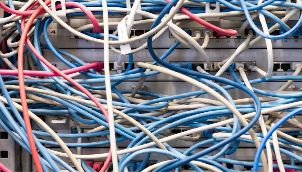
The NKE devices communicated fine between each other on the topline bus just out of the box, but for the Garmin chartplotter some more steps have been necessary. The Garmin chartplotter uses NMEA2000, a different communication protocol and bus system which was not compatible with the Topline NKE bus. To make this work, a way had to be found to bridge the gap between the two systems.
The Topline NKE proprietary bus is a type of communication bus developed and used by the company NKE for their electronic systems. It is a proprietary system, meaning it is owned and controlled by NKE and is not open to other manufacturers or users. It is used to connect and communicate between various electronic devices and systems on a boat.
In order to get the information like depth, speed, wind angle, wind speed and autopilot data to the chart plotter, the Garmin chartplotter needed to communicate with the NKE system over an NMEA2000 bus or a NMEA0183.
On the other hand I needed a way to bring all my GPS and AIS data from the weatherdock AIS device to the NKE autopilot. The AIS also supports only NMEA2000 and NMEA 0183.
The NMEA0183 is not a bus but a point to point communication between 2 dedicated devices. I don’t like this primitive communication system, because it can get really complicated if you enlarge the number of devices. So I decided to use the NMEA2000 bus system to connect the Garmin chartplotter. It is based on the Controller Area Network (CAN) bus technology.
How to connect Topline bus to NMEA2000?
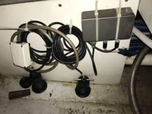
However, the NKE system in the 2022 version did not have any NMEA2000 interface device. To solve this issue, I used a device called Yacht Devices YDNG-03 to convert the NMEA2000 bus information to NMEA0183 which was directly connected with the NKE USB box. The NKE USB box then sent/receive the information on/from the Topline bus. The Yacht Devices YDNG-03 also provides a nice feature to filter the data exchange between both bus systems. That way you can limit the traffic on both busses.
This solution allowed me to integrate the Garmin chartplotter and the AIS System into the existing NKE navigation system and make sure that all the data from the sensors is shared seamlessly between the two systems. It required a bit of effort to set up but it was worth it as now I have a more complete navigation system on my boat.
News 2023 from NKE
It may sound complicated, but it works. In 2023, NKE also solved this problem by releasing an update for the NKE USB box. The updated version now has an integrated input for NMEA2000, eliminating the need for the Yacht Devices YDNG-03 device. This makes the integration of other devices, like the Garmin chartplotter, into the NKE system much easier.
In my next post, I will provide more details on the difficulties I encountered during the process of upgrading my system, specifically when I decided to replace my old, hard-to-read black and white display with a new NKE multifunction display and remove some other outdated NKE devices from the network. It got tricky. More in my next post.
I hope that this information helps other boat owners who are looking to update their NKE systems. It is important to research and understand the different communication protocols and bus systems used by different navigation instruments before making any updates, and to be aware that compatibility issues may arise. However, with the right tools and knowledge, updating a navigation system can be a manageable task.
![Read more about the article What is the required amount of electric power needed for cooking on a boat? [measurements]](https://sv-tatooine.com/wp-content/uploads/2023/03/Ente_Kloese_Rotkohl-300x174.png)